
Most visitors to the southern Oregon coast drive straight to the beach and stop there. That is a mistake. The scenic drives near Gold Beach Oregon that run inland and up the coastal ridgelines offer something the shoreline cannot: perspective. Carpenterville Road and the Edson Creek Loop put you above the fog, into old-growth forest corridors, and across open meadows with unobstructed Pacific views that rival anything on the coast highway. If you are planning a trip to Gold Beach and skipping these routes, you are leaving the best part of the trip behind.
Table of Contents
- Quick Takeaways
- Why These Drives Matter for Gold Beach Visitors
- Carpenterville Road Oregon: The Coastal Ridge Classic
- Edson Creek Loop Gold Beach: The Forest Interior Route
- Comparing the Southern Oregon Coast Drives
- Best Time and Conditions for Both Routes
- Practical Planning from Gold Beach
- Frequently Asked Questions
- References
Quick Takeaways
| Key Insight | Explanation |
|---|---|
| Carpenterville Road is a paved scenic byway | The road runs roughly 12 miles along the coastal ridge between Gold Beach and Pistol River, offering sporadic Pacific Ocean panoramas without requiring a high-clearance vehicle. |
| Edson Creek Loop passes through old-growth forest | This lesser-known route connects inland timber roads near the Rogue River corridor, delivering dense canopy, creek crossings, and genuine solitude that the main highway cannot match. |
| Morning light favors Carpenterville Road | East-facing meadow overlooks along Carpenterville catch sunrise light over the coastal range before ocean fog typically burns off by 10 a.m. in summer. |
| The Edson Creek route requires a reliable vehicle | Sections of the loop use gravel forest roads. A standard passenger car can navigate it in dry conditions, but low clearance is a genuine risk after autumn rains. |
| Both drives are under 25 miles from downtown Gold Beach | You can complete either route as a half-day excursion and return to Gold Beach for a meal, making them ideal add-ons to jet boat trips or beach days. |
| Carpenterville Road connects to Samuel H. Boardman State Scenic Corridor | The southern terminus drops back to US-101 near Pistol River, allowing drivers to extend into the Boardman corridor, one of the most photographed coastlines in the Pacific Northwest. |
| Cell service is largely absent on both routes | Download offline maps, carry a paper backup, and fill your gas tank in Gold Beach before departing. There are no services once you leave the highway. |
Why These Drives Matter for Gold Beach Visitors
Gold Beach sits at a geographic intersection that most coastal towns simply do not have. The Wild and Scenic Rogue River meets the Pacific directly at town, the Klamath Mountains push ridges almost to the waterline, and the climate in this stretch of southern Oregon is mild enough year-round that road access stays open when northern Oregon passes get snowed in. That combination means the scenic drives available here are not just pretty, they are genuinely accessible and diverse in what they show you.
Carpenterville Road and the Edson Creek Loop represent two entirely different ecosystems separated by less than 20 road miles. Carpenterville is ridge-top and ocean-facing. Edson Creek is riparian and forest-dense. Running both routes on the same visit is not overkill. It is actually the most efficient way to understand the full landscape surrounding Gold Beach.
This matters practically for visitors who come for outdoor recreation. Anglers waiting for the tide window on the lower Rogue, hikers who have already done beach trails, and families looking for a low-effort scenic payoff all benefit from knowing these routes exist. The drives do not require permits, special equipment, or physical fitness. They reward anyone willing to turn off US-101 and follow a ridge for a few miles.
Carpenterville Road Oregon: The Coastal Ridge Classic
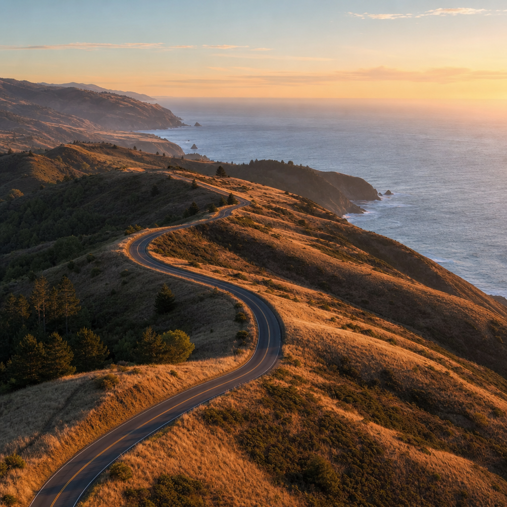
Carpenterville Road is the drive that Gold Beach regulars recommend first and that first-time visitors consistently say they wish they had done sooner. The road climbs from US-101 approximately 4 miles north of Brookings and runs north along the coastal ridge, rejoining the highway near Gold Beach. While maintained as a paved route, which means it handles two-way traffic without requiring any special vehicle preparation, there may be stretches of dirt road awaiting repair.
The Ridge Views and What You Are Actually Seeing
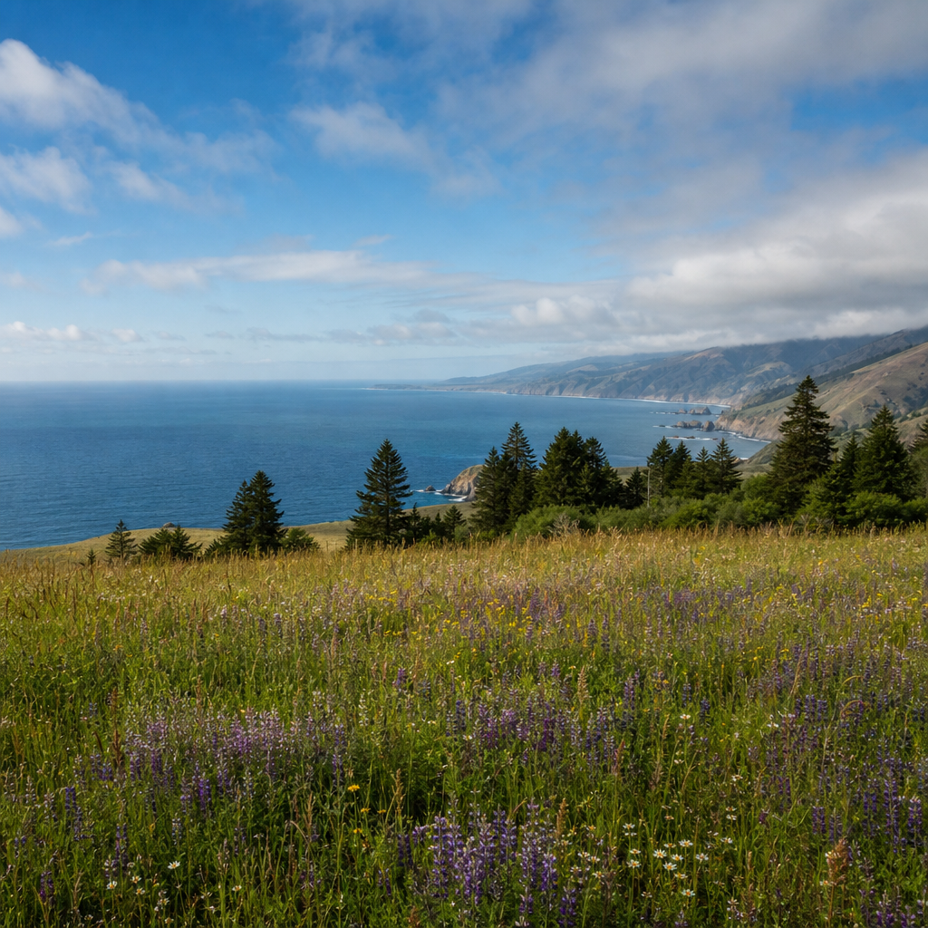
From the high points along Carpenterville, you are looking west at open Pacific Ocean from an elevation between 1,000 and 1,500 feet. On a clear day, the horizon line is unbroken for the full width of your field of vision. Below and to the west, the coastal meadows and the narrow strip of US-101 look small. To the east, the Siskiyou foothills roll away toward the Klamath Mountains. This is not a highway median viewpoint. It is a genuine ridgeline with exposure on both sides.
The road passes through private grazing land and state forest alternately. Cattle sometimes cross the road in the open meadow sections. Drive at 25 mph through those stretches regardless of posted limits.
Stopping Points Worth Your Time
There are informal pull-off areas approximately every 2 to 3 miles where the road widens at promontories. The pull-off closest to the northern terminus, roughly 2 miles before the road returns to US-101, offers the clearest view north toward the Rogue River mouth and the Gold Beach shoreline. This is the specific overlook that rewards the drive most consistently. The view south from the same point shows the Brookings coastline on clear days, a span of roughly 10 miles of Pacific shoreline in a single frame.
Pro tip: Drive Carpenterville Road northbound, starting from the Brookings end. This puts the ocean views on your left side as the driver, which is the natural sightline when you control the vehicle. Driving it southbound means the panoramas are on the passenger side and you spend more mental energy managing the road edge on the cliff side.
Road Conditions and Realistic Timing
The full length of Carpenterville Road takes approximately 45 minutes to drive without stops. Add 30 to 45 minutes if you intend to stop at overlooks. The surface is mostly paved but narrow with sharp curves on the descent toward Gold Beach. Fog is common before 10 a.m. from June through August. The clearest driving windows are between 10 a.m. and 3 p.m. in summer and mid-morning in winter when marine layers are thinner at this latitude than they are farther north near Cannon Beach.
Edson Creek Loop Gold Beach: The Forest Interior Route
Where Carpenterville Road is open sky and ocean, the Edson Creek Loop is something completely different. This route takes you into the managed forest and natural creek drainage east of Gold Beach, into the kind of landscape that Rogue River jet boat passengers see from the water but rarely access overland. The loop uses a combination of paved county road and gravel BLM and Forest Service road, and it delivers a forest interior experience that is genuinely uncommon this close to a Pacific coast town.
The Route Structure
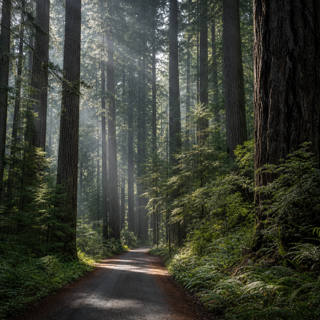
The most practical entry point is from the north bank of the Rogue River, heading east on Jerry’s Flat Road from Gold Beach. From there, the loop climbs into the drainage system feeding the lower Rogue, passing through second-growth Douglas fir, Port Orford cedar, and stretches of older timber that survived the logging decades. Edson Creek itself is a tributary of the Rogue, and the road follows the creek drainage for several miles before looping back toward the coast highway. Total loop distance, depending on the exact variation driven, runs between 18 and 22 miles.
Pro tip: The gravel sections of the Edson Creek Loop are best driven between May and October. November through March, the road surface collects standing water in the low sections and the creek crossings become unpredictable after heavy rain events. Check road conditions with the Gold Beach Ranger District of the Rogue River-Siskiyou National Forest before visiting in shoulder seasons.
What the Forest Sections Show You
The old-growth fragments along the creek drainage are the main draw for hikers who use the loop as a basecamp approach. Sitka spruce and Douglas fir with trunk diameters over 4 feet appear in the lower creek sections. Understory growth is dense: sword fern, oxalis, and vine maple create the classic western Oregon forest floor. In autumn, bigleaf maple turns orange along the creek corridor, and this is one of the few places in Curry County where fall color is genuinely worth driving to see.
Wildlife encounters on this route are more frequent than on Carpenterville Road. Black-tailed deer are common year-round. Black bear sign, including claw marks on snags and overturned logs, appears regularly along the creek drainage. Spotted owl habitat has been documented in several old-growth fragments along the route by Oregon Department of Fish and Wildlife surveys.
Comparing the Southern Oregon Coast Drives
Gold Beach is not the only southern Oregon coast town marketing itself as a scenic drive destination. Brookings to the south and Port Orford to the north both offer scenic routes. The honest comparison matters because visitors make real decisions about where to base themselves based on drive quality and variety.
| Route / Area | Primary Experience | Practical Access from Gold Beach |
|---|---|---|
| Carpenterville Road (Gold Beach / Brookings corridor) | Mostly paved coastal ridge drive with unobstructed Pacific panoramas, 12 miles of exposed ridgeline, accessible to all vehicles year-round | Northern terminus is within 5 miles of downtown Gold Beach on US-101. Full loop takes under 2 hours including stops. |
| Edson Creek Loop (Gold Beach inland) | Mixed pavement and gravel forest route through old-growth fragments and creek drainage, wildlife emphasis, minimal traffic | Entry off Jerry’s Flat Road in Gold Beach. Dry-season access recommended. 18 to 22 miles total loop. |
| Cape Sebastian to Port Orford stretch of US-101 | Highway-level coastal views with formal overlooks, accessible without leaving US-101, higher traffic volume | Cape Sebastian is less than ten miles south of Gold Beach. No special routing required but limited off-highway exploration options. |
The comparison makes the Gold Beach advantage clear. Carpenterville Road and the Edson Creek Loop are not variations of the same experience. They are genuinely different ecosystems requiring different moods and different amounts of time. No other single base town on the southern Oregon coast, including Brookings or Port Orford, puts two that distinct within 25 miles.
“The Rogue-Siskiyou region contains one of the highest concentrations of endemic plant species in North America, a direct result of the Klamath Mountain uplift creating isolated ecological pockets on the coastal ridges.” – Oregon Department of Forestry, Klamath-Siskiyou Ecological Region Overview
Best Time and Conditions for Both Routes
Gold Beach’s reputation as Oregon’s banana belt is not marketing spin. The town averages roughly 70+ inches of annual rainfall, compared to over 88 inches in the Tillamook area to the north, and temperatures rarely drop below freezing at sea level. This directly affects drive planning because the roads here stay open and navigable in months when comparable routes in northern Oregon or the Cascades are closed.
Summer Driving: June Through September
Summer is the most reliable window for both routes. Carpenterville Road is clear of morning fog by mid-morning on most days. The Edson Creek Loop gravel sections are dry and compacted. July and August bring the highest chance of all-day visibility on Carpenterville. The trade-off is that summer is also when Gold Beach sees its highest tourist volume, and while neither drive gets traffic comparable to US-101, Carpenterville Road does see camper van traffic in peak summer that slows progress on the narrower sections.
Fall Driving: October and November
October is arguably the best month for the Edson Creek Loop. Creek levels are still manageable, the bigleaf maple color is at peak, and the tourist crowds that define summer in Gold Beach are gone. Carpenterville Road in October delivers dramatic low-light conditions in the afternoon that summer’s flat midday light cannot match. November is the beginning of the true rain season, and the Edson Creek gravel sections start becoming unreliable after the first sustained rain events.
Winter and Spring Driving
Winter driving on Carpenterville Road is entirely feasible and delivers storm-watching views from the ridge that are spectacular in the right conditions. The road is paved and maintained. The Edson Creek Loop in winter is a different calculation. The gravel sections can develop soft shoulders and the creek crossings carry real water. Spring, from March through May, is the transition window. Carpenterville is excellent from mid-March onward. The Edson Creek Loop is best held until late May when road surfaces have recovered from winter saturation.
Practical Planning from Gold Beach
Both routes are day-trip length from any lodging in Gold Beach. The town has fuel, groceries, and food options concentrated along US-101 and the immediate riverfront area. Once you leave on either route, there are no services until you return to the highway.
Navigation and Maps
Carpenterville Road appears on Google Maps and Apple Maps without issue. The Edson Creek Loop requires more care because the gravel forest road segments are sometimes mislabeled or listed as closed when they are passable. The most reliable source for current road status is the Gold Beach Ranger District of the Rogue River-Siskiyou National Forest. Their office on Moore Street in Gold Beach can confirm which forest road segments are open for the current season before you depart. Calling ahead saves a wasted drive.
Combining Both Routes into One Day
A motivated driver can complete both Carpenterville Road and the Edson Creek Loop in a single full day out of Gold Beach. The practical sequence is Edson Creek first in the morning, returning to Gold Beach by midday, then heading south to pick up Carpenterville northbound in the afternoon when the light is best for westward-facing ocean views. This itinerary runs approximately 6 to 7 hours including stops and a lunch break in Gold Beach between routes.
Visitors who have already booked jet boat tours on the Rogue River, which run from the Gold Beach marina and cover the lower river canyon, will find the Edson Creek Loop gives them an overland counterpart to the river experience. The same forest drainage the boats pass beneath is what the loop road passes through above.
What to Bring
The basics for either route are: full fuel tank before leaving Gold Beach, downloaded offline maps (Google Maps offline or Gaia GPS), a printed backup for the Edson Creek forest road segments, water and food for at least half a day, and a vehicle with reasonably current tires. High clearance is not required for Carpenterville Road under any conditions. It is a genuine asset on the Edson Creek Loop in shoulder seasons. Cell service returns once you descend back to US-101 elevation on either route.
Frequently Asked Questions
Is Carpenterville Road suitable for RVs and large vehicles?
Carpenterville Road is mostly paved and two-lane but includes sharp curves and narrow sections that create real difficulty for vehicles over 25 feet. Class B vans and truck campers handle it without issue. Full-size Class A motorhomes and fifth wheels longer than 25 feet will find several switchback sections on the Gold Beach descent too tight to navigate safely. Passenger cars, SUVs, and pickup trucks have no restrictions on this route.
How long does it take to drive the Edson Creek Loop without stops?
The driving time for the full loop without stops is approximately 1 hour 15 minutes to 1 hour 30 minutes, depending on which forest road variant you use. The gravel sections require reduced speed, typically 15 to 20 mph, which adds time compared to what the mileage suggests. Budget 2 to 3 hours if you plan to stop for the old-growth sections or creek access points.
Are there any fees or permits required for these routes?
Neither Carpenterville Road nor the Edson Creek Loop requires a permit or entry fee for driving. Sections of the Edson Creek Loop pass through Rogue River-Siskiyou National Forest land, where dispersed camping requires adherence to National Forest rules but day-use driving does not require a Northwest Forest Pass. If you plan to park and hike on Forest Service trailheads along the loop, a Northwest Forest Pass may be required at specific signed trailheads.
What is the best season for scenic drives near Gold Beach Oregon?
July through October is the strongest window for both routes combined. July and August deliver the clearest Carpenterville Road views with reliable fog burn-off. October delivers the best Edson Creek Loop forest color and the lowest tourist traffic on both routes. The Gold Beach banana belt climate means neither route is off-limits in winter, but the Edson Creek gravel sections become unreliable from November through early April after sustained rainfall.
Can I access Samuel H. Boardman State Scenic Corridor from Carpenterville Road?
Yes. The southern end of Carpenterville Road descends back to US-101 in the Pistol River area, approximately 10 miles south of Gold Beach. From that junction, driving south on US-101 puts you directly into the Samuel H. Boardman State Scenic Corridor within minutes. The corridor runs approximately 12 miles along the coast between Pistol River and Brookings and contains some of the most dramatic sea stack and arch formations on the entire Oregon coast. Combining Carpenterville Road with a Boardman corridor stop is a logical full-day itinerary from Gold Beach.
How does Carpenterville Road compare to the Three Capes Scenic Route near Tillamook?
The two routes are genuinely different in character. The Three Capes Scenic Route near Tillamook stays closer to sea level and emphasizes headland and bay views. Carpenterville Road runs at ridge elevation with more exposed panoramic ocean views and far less traffic. Carpenterville also connects to genuine forest interior routes like the Edson Creek Loop, which has no equivalent in the Tillamook area. For visitors choosing between northern and southern Oregon coast destinations, the drive variety around Gold Beach is a meaningful practical advantage.
Have you driven Carpenterville Road or the Edson Creek Loop on a visit to Gold Beach? Share what conditions you found and which stopping points surprised you most.
References
- USDA Forest Service homepage, including Rogue River-Siskiyou National Forest road and recreation information
- Oregon State University research hub covering Klamath-Siskiyou ecology and Pacific coast forest systems
- State of Oregon official portal, including Oregon Department of Transportation road condition resources and state scenic byway designations
- Statista data platform with U.S. domestic travel statistics and Pacific Coast tourism volume trends
- National Park Service website covering Wild and Scenic River designations including the Rogue River corridor relevant to the Edson Creek drainage area