
Most coastal towns give you two options: sit on the sand or drive inland for scenery. Gold Beach, Oregon refuses that compromise. Within 20 minutes of the Rogue River mouth, you can be standing in old-growth myrtle forest, scrambling above sea cliffs with unobstructed Pacific views, or walking through protected wilderness that sees a fraction of the crowds found at Cannon Beach. The Gold Beach Oregon hikes listed below are not generic trail suggestions pulled from a database. They are specific routes, with real trail conditions, honest difficulty ratings, and the kind of detail that separates a good summer day from a wasted one.
Table of Contents
- Quick Takeaways
- Cape Sebastian Trail: The Premier Coastal Viewpoint Hike
- Myrtle Tree Trail: The Tallest Myrtle in the World
- Otter Point Hike: Short, Dramatic, and Underrated
- Francis Shrader Old Growth Trail: Into the Forest Interior
- Trail Comparison: Which Hike Fits Your Summer Plans
- Summer Hiking Tips Specific to the Gold Beach Area
- Frequently Asked Questions
- References
Quick Takeaways
| Key Insight | Explanation |
|---|---|
| Cape Sebastian delivers the best views per effort of any trail near Gold Beach | The 3-mile round-trip route gains roughly 200 feet and rewards hikers with sweeping Pacific panoramas stretching up to 50 miles on clear days. |
| Summer mornings are the optimal window for coastal hikes here | Gold Beach sits in the Oregon “banana belt,” meaning less fog and rain than northern coastal towns, but afternoon wind picks up sharply along exposed headlands. |
| The Myrtle Tree Trail is family-friendly and genuinely unique | The trail leads to the largest myrtle tree in the world, a fact verified by American Forests. It is an easy 1.4-mile round-trip with minimal elevation gain. |
| Otter Point is the most overlooked hike near Gold Beach | Most visitors drive past it. The 1-mile loop along sea cliffs offers tide pool access and solitude that longer routes cannot match. |
| Francis Shrader Old Growth Trail is the best choice for heat avoidance | Dense old-growth canopy keeps temperatures 10 to 15 degrees cooler than exposed coastal trails, making it ideal for warm summer afternoons. |
| Oregon State Park day-use fees apply at several trailheads | An Oregon Pacific Coast Passport ($10 for five days) covers most state park day-use fees along the coast and is worth purchasing if you plan multiple hikes. |
| Cell service is unreliable on most of these trails | Download offline maps via AllTrails or Gaia GPS before leaving your lodging in Gold Beach. Do not rely on real-time navigation once you leave the highway corridor. |
Cape Sebastian Trail: The Premier Coastal Viewpoint Hike
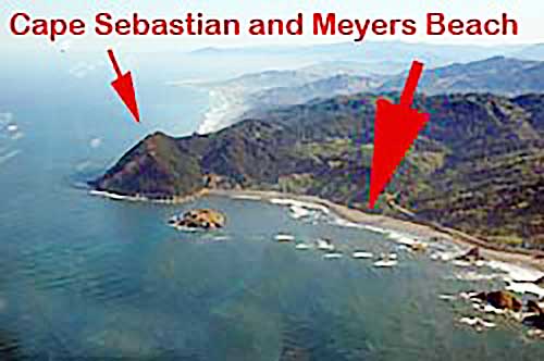
If you only hike one trail near Gold Beach this summer, make it the Cape Sebastian Trail. The trailhead sits 7 miles south of town off US-101, on the way south to the Samuel H. Boardman Scenic Corridor. The north viewpoint parking area is the better starting point: it puts you at elevation immediately and lets you descend through coastal scrub rather than grind uphill in afternoon wind.
The trail runs roughly 1.5 miles one way to the south viewpoint, keeping mostly to the headland ridge before dipping toward sea level. Round-trip distance is approximately 3 miles with about 200 feet of elevation change total. Oregon State Parks rates it as moderate, but in practice, most reasonably fit adults will find it easy to moderate. The challenge is not the grade. It is the exposure to wind and the rocky footing near the southern terminus.
What You Will Actually See
On a clear summer morning, the view from Cape Sebastian spans from Humbug Mountain to the north to Point St. George in California to the south. That is a legitimate 50-mile coastal panorama from a single vantage point. Bring binoculars. Gray whale sightings are common in summer as gray whales feed closer to shore, and harbor seals haul out on the rocks below the south viewpoint.
The wildflower display along the ridge in June and early July is exceptional. Coast paintbrush, lupine, and sea thrift cover the headland in dense color. By August, the blooms fade but the views remain and crowds thin further.
Practical Notes for Summer Visitors
Arrive before 9 a.m. The north parking area holds roughly 20 cars. By mid-morning on weekends, overflow parking becomes a real problem. Weekdays are substantially quieter. Wear layers even in July. The ridge sits fully exposed and wind chills can make 65-degree air feel like 50.
Pro tip: The south viewpoint parking area offers a different trailhead option if the north lot is full. Starting from the south adds a modest uphill section early in the hike but is entirely manageable.
Myrtle Tree Trail: The Tallest Myrtle in the World
The Myrtle Tree Trail inside Myrtle Tree State Natural Site is 14 miles northeast of Gold Beach on Jerry’s Flat Road. That inland drive takes you away from the coast and into the Rogue River corridor, which is already a worthwhile detour on its own. The trail itself is only 1.4 miles round-trip with about 100 feet of elevation gain, making it the most accessible option on this list for families with young children or visitors who want forest atmosphere without physical demand.
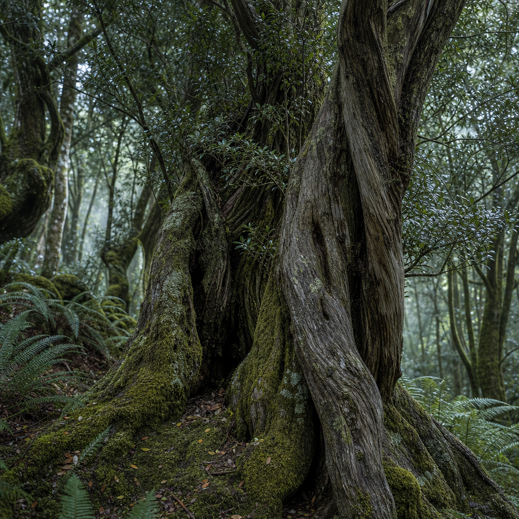
The destination is a Pacific myrtle tree recognized by American Forests as the largest of its species in the world. The trunk circumference exceeds 42 feet at breast height. Standing next to it resets your internal sense of scale in a way that photographs do not capture.
Why This Trail Gets Overlooked
Most hiking recommendation sites skip this trail because it lacks dramatic elevation or coastal views. That is exactly why it deserves attention. The forest along this route is genuinely old-growth. The understory is dense with ferns, and the myrtle canopy filters summer light into something close to stained glass. On a warm summer afternoon when exposed coastal headlands are windy and bright, this trail is a refuge.
The trail surface is uneven packed dirt with some roots. Wet conditions make it slippery, but summer visits are generally dry and stable. There are no facilities at the trailhead, so plan accordingly.
Pro tip: Combine the Myrtle Tree Trail with a jet boat tour from Gold Beach for a full day itinerary. The trailhead is close to Jerry’s Flat Road, which runs alongside the Rogue. You can hike in the morning and be back in Gold Beach for an afternoon jet boat departure without rushing.
“The Pacific myrtle, also known as Oregon myrtle or California bay laurel, is one of the most distinctive native trees on the Pacific Coast. The specimen at Myrtle Tree State Natural Site stands as a record of what undisturbed Pacific Coast forest produces over centuries.” – American Forests Big Tree Registry documentation on record native species
Otter Point Hike: Short, Dramatic, and Underrated
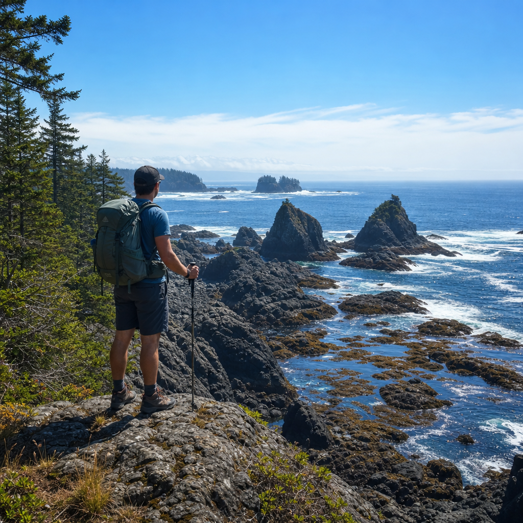
The Otter Point hike at Otter Point State Recreation Site sits 4 miles north of Gold Beach off US-101. The loop is approximately 1 mile and gains minimal elevation. What it lacks in distance it makes up for in raw coastal drama. The trail follows sea cliffs above rocky outcroppings where harbor seals and Steller sea lions regularly congregate. Tide pools at the base of the cliffs are among the most accessible on the southern Oregon coast.
A common mistake is treating Otter Point as a quick roadside stop rather than a deliberate hike. The cliff-edge path requires attention. The ground is uneven and drops sharply on the ocean side. Children need supervision near the exposed sections. That said, the route is short enough that even casual walkers can complete it comfortably.
Best Conditions for the Otter Point Loop
Low tide timing matters here. Check the NOAA tide prediction tables before you go. A minus tide exposes the rocky shelves below the cliffs and gives you access to the best tide pool areas. The window around a minus-1 or minus-2 foot tide reveals sea stars, hermit crabs, anemones, and chitons in concentrations that exceed what you will find at more publicized tide pool sites further north on the Oregon coast.
Summer afternoons bring gusty northwest winds to this stretch of coast. Morning visits are calmer and often clearer. The parking area is small, roughly 10 vehicles, and fills quickly on summer weekends. Arriving by 8 a.m. guarantees a spot.
Francis Shrader Old Growth Trail: Into the Forest Interior
The Francis Shrader Old Growth Trail is approximately 12 miles up the South Bank of the Rogue River beginning on Jerry’s Flat Road 10 miles turning right on Forest Road 090 for another two miles. The trail is a gentle round-trip with groomed trails and bridges.
The route climbs through old-growth Douglas fir, Port Orford cedar, and tanoak. The canopy density is extraordinary. Even on the warmest summer days, the forest interior stays noticeably cool. This is the trail to choose when coastal headlands are baking in afternoon sun or when you want to be genuinely inside the landscape rather than observing it from a ridge.
Humbug Mountain: Summit Experience and What to Expect at the Top
Humbug Mountain can be found approximately 26 miles north along Highway 101. The trail is 5.5 miles round-trip with about 1,700 feet of elevation gain, which puts it firmly in the moderate-to-strenuous category. It is the only trail here that qualifies as a genuine workout, and it is also the most rewarding for hikers who want forest immersion rather than coastal views.
The summit of Humbug Mountain reaches 1,756 feet. Views from the top look south toward Gold Beach, north toward Port Orford, and west over the open Pacific. The final 0.5 miles gains elevation steeply, and the rocky summit area requires careful footing. Most fit hikers complete the round-trip in 3 to 4 hours.
The trailhead is inside Humbug Mountain State Park, which charges a day-use fee. The Oregon Pacific Coast Passport covers this fee. Bring at least 2 liters of water per person. There is no water source on the trail after the first quarter mile. The trail is well-maintained by Oregon State Parks and signed clearly at all junctions.
Wildlife Along the Trail
Roosevelt elk use this forest corridor regularly. Early morning starts in summer frequently produce elk sightings in the lower meadow sections near the trailhead. Black-tailed deer are nearly guaranteed. In the old-growth sections midway up, listen for the territorial drumming of pileated woodpeckers, the largest woodpecker species in North America.
Trail Comparison: Which Hike Fits Your Summer Plans
| Trail | Distance and Difficulty | Best For |
|---|---|---|
| Cape Sebastian Trail | 3 miles round-trip, easy to moderate, 200 ft gain | First-time visitors, coastal view seekers, photographers, wildflower viewing in June and July |
| Myrtle Tree Trail | 1.4 miles round-trip, easy, 100 ft gain | Families with young children, nature lovers, visitors combining with Rogue River activities |
| Otter Point Hike | 1 mile loop, easy, minimal gain | Tide pool access, wildlife watching, casual walkers, low-tide morning visits |
| Francis Shrader Old Growth Trail | 1 mile loop, easy, minimal gain | Old-growth trees, primarily Douglas-fir and Port Orford cedar |
| Humbug Mountain | 5.5 miles round-trip, moderate to strenuous, 1,700 ft gain | Experienced hikers, forest immersion, hot summer afternoons, summit views |
Summer Hiking Tips Specific to the Gold Beach Area
Gold Beach’s “banana belt” reputation is earned. The town receives significantly less summer rain than coastal Oregon communities to the north. Brookings, just 27 miles south, holds the Oregon record for highest temperature ever recorded. But mild air temperatures on the coast do not mean conditions are uniform. Every hike on this list sits in a microclimate that requires slightly different preparation.
On exposed coastal headlands like Cape Sebastian and Otter Point, wind is the primary hazard in summer, not heat. Northwest winds regularly reach 20 to 30 mph by early afternoon from late June through August. A windbreaker or light shell is not optional gear. It is basic equipment for any afternoon coastal hike near Gold Beach.
Footwear and Trail Surface Reality
Trail runners or low-cut hiking shoes are appropriate for all four routes listed here. Full ankle-height boots are unnecessary for the shorter coastal trails but make sense for the Francis Shrader climb where the descent on loose rock benefits from better ankle support. Sandals are not appropriate on any of these trails. The Otter Point cliff sections and the Humbug Mountain summit both involve uneven rocky terrain where open-toed footwear creates genuine risk.
Parking and Trailhead Access in Summer
Summer weekends from late June through Labor Day put real pressure on trailhead parking at Cape Sebastian and Otter Point. The Oregon Coast sees its peak visitation in July and August. Arriving before 9 a.m. solves this problem at every trailhead on this list. Alternatively, mid-week visits are dramatically less congested. If you are staying in Gold Beach, Tuesday through Thursday hiking is the optimal window for solitude.
The things to do in Gold Beach page on the official Gold Beach website is a useful starting point for planning a full itinerary around these hikes, including lodging options close to the US-101 corridor that minimize morning drive times to trailheads.
Pro tip: Download trail maps before your trip. Cell service on the trails ranges from weak to nonexistent. The Gaia GPS app allows full offline map downloads for these specific trail areas. AllTrails Premium offers the same offline functionality. Either works. Neither substitutes for printed backup map of the Boardman Corridor if you plan to explore beyond the main Cape Sebastian route.
Frequently Asked Questions
Are these Gold Beach Oregon hikes suitable for kids?
The Myrtle Tree Trail and Otter Point loop are both excellent choices for families with children. Both are under 1.5 miles round-trip with minimal elevation gain. Cape Sebastian is manageable for older children who are comfortable on uneven terrain. The Francis Shrader Old Growth Trail is not recommended for young children due to the 1,700-foot elevation gain and 5.5-mile total distance.
Do I need a permit to hike at Cape Sebastian or Otter Point?
No permit is required for trail access. However, a day-use parking fee applies at Humbug Mountain State Park. An Oregon Pacific Coast Passport ($10 for five days) covers this fee and is accepted at most Oregon State Park day-use areas along the coast. Purchase it online through the Oregon State Parks website before your visit.
What is the best time of day to hike Cape Sebastian in summer?
Early morning, before 9 a.m., is strongly recommended. Parking fills quickly on summer weekends by mid-morning. Morning conditions also produce calmer winds and better visibility for coastal views. Afternoon northwest winds on the exposed headland can reach 25 mph or more, which makes the exposed ridge sections less comfortable and reduces visibility from windblown sea spray.
Is Humbug Mountain safe to hike alone?
The trail is well-maintained and clearly signed by Oregon State Parks. Solo hiking is common here. That said, the 1,700-foot elevation gain and rocky summit approach make it a trail where one twisted ankle in poor footwear can become a serious problem. Carry a charged phone with an offline map downloaded, wear appropriate footwear, and tell someone at your lodging your planned return time. Cell service on the upper sections is unreliable.
Can I see whales from the Cape Sebastian Trail?
Yes. Gray whales are present along the southern Oregon coast throughout summer as they feed in nearshore kelp beds and feeding areas. The elevated north and south viewpoints on Cape Sebastian provide excellent scanning angles for whale spotting. Binoculars significantly improve your chances. Morning visits with calm sea conditions are the most productive for wildlife observation from this headland.
Are dogs allowed on these trails?
Dogs are allowed on all four trails listed here but must remain on leash at all times. Oregon State Park regulations require a 6-foot maximum leash in all state park areas. The Myrtle Tree Trail is the most dog-friendly in terms of terrain. The Otter Point cliff sections require careful management of dogs on leash due to the exposed drop-offs near the trail edge.
How does Gold Beach compare to Cannon Beach for coastal hiking?
Gold Beach offers a meaningfully different experience. Cannon Beach is heavily visited and the trails near it, including Ecola State Park routes, see significant summer crowds. Gold Beach hikes like Cape Sebastian and Otter Point deliver comparable or superior coastal scenery with a fraction of the foot traffic. The banana belt climate also means more reliable summer weather than the northern Oregon coast. Visitors who prioritize solitude and scenery over amenities and accessibility will find Gold Beach hiking more satisfying.
Have you hiked any of these trails near Gold Beach? Share your experience or questions in the comments below. We would especially like to hear from hikers who have attempted the Francis Shrader summit in late summer conditions.
References
- Oregon State Parks official site covering trail conditions, fees, and recreation information for Samuel H. Boardman Scenic Corridor and Humbug Mountain State Park
- USDA Forest Service national forest and wilderness trail information for the Rogue River-Siskiyou National Forest surrounding Gold Beach
- NOAA Tides and Currents official tide prediction tool for planning tide pool access at Otter Point and coastal Gold Beach areas
- American Forests Big Tree Registry documentation on record native tree species including the champion myrtle tree near Gold Beach
- Statista travel and tourism data on Oregon coastal visitation trends and national park and state park usage statistics